
For the first time in 20 years, the Ramsar Convention on Wetlands (COP15) returns to Africa, with its debut in Southern Africa, at Victoria Falls from 23-31 July. Amid growing threats to the continent’s wetlands—including urbanisation, agricultural expansion, pollution and climate change impacts—Digital Earth Africa (DE Africa) will unveil powerful new tools aimed at transforming wetland monitoring and conservation for African nations. Aligned with Ramsar’s mission to promote the wise use of wetlands, these tools add to the Digital Earth Africa suite of water monitoring and evaluation tools, offering new ways for wetland managers and decision makers to address water accessibility and variability challenges across the continent.
The new Wetlands Monitoring Workflow and online Wetlands Monitoring training module are designed to empower African stakeholders with the capabilities to monitor, manage, and report on wetland ecosystems using Earth observation data. Building on the Water Observations from Space (WOfS), Waterbodies Monitoring Service and the Wetland Insight Tool, these tools address the critical lack of accessible, up-to-date, and scalable wetland monitoring resources across Africa, a gap that has long hindered the capacity of countries to meet global environmental commitments.
“Wetlands are at the heart of Africa’s environmental and economic resilience, supporting flood regulation, food systems, biodiversity, water security and millions of livelihoods,” says Dr Lisa-Maria Rebelo, Managing Director (Ag) and Lead Scientist at Digital Earth Africa. “These tools, generated in Africa for Africans, enable those involved in the management of water and wetland resources to better understand surface water availability, quality, and changes over the past three decades. We’re committed to empowering African institutions with actionable satellite data and insights so that these vital ecosystems can be monitored and managed sustainably.”
Addressing the urgency of wetland loss in Africa
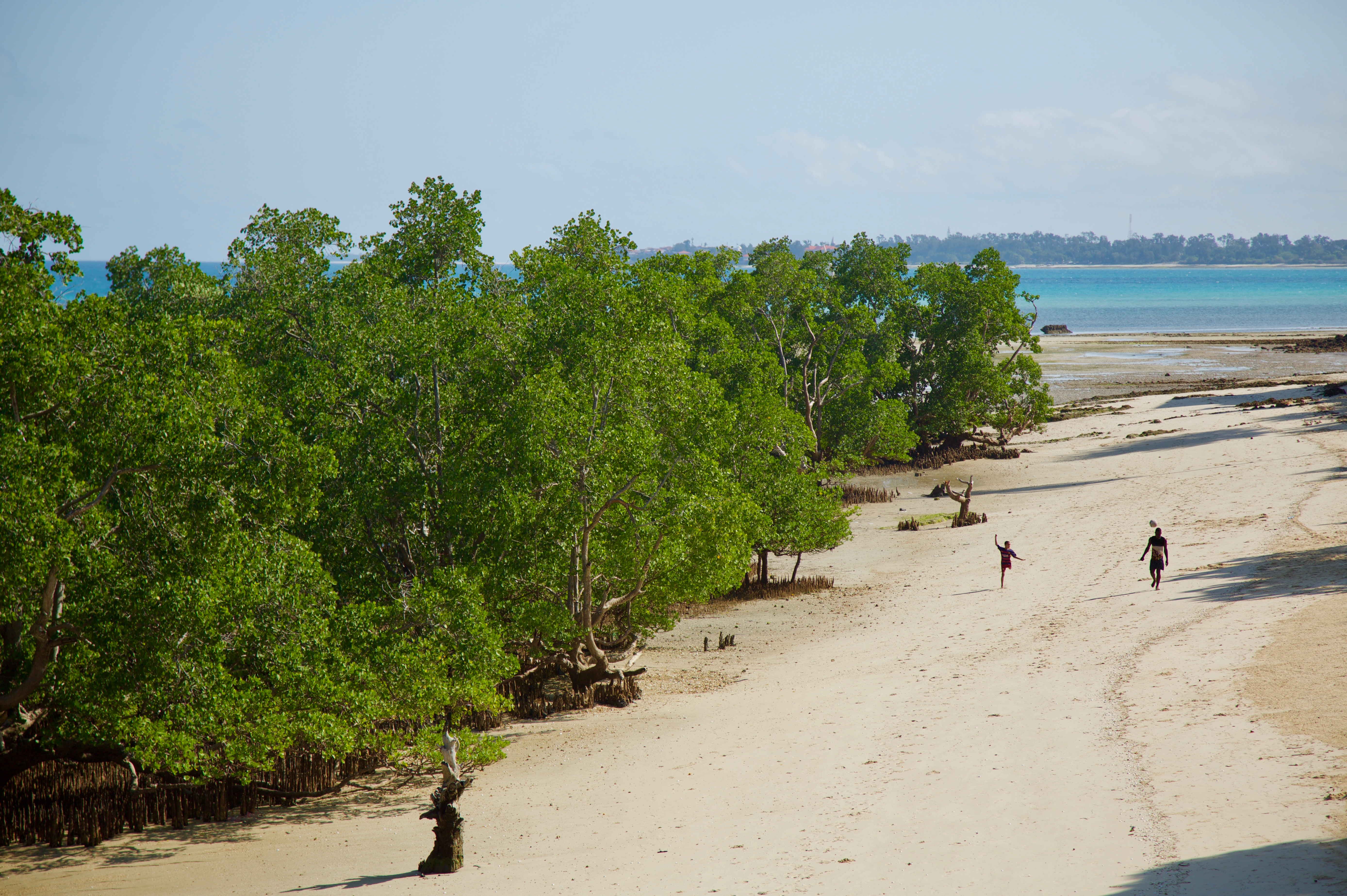
From coastal wetlands in Ghana being clogged by UK clothing dumps, to climate change threatening mangroves in Zanzibar, to Zimbabwe’s fragile wetlands being compromised by agriculture and urbanisation, wetlands throughout Africa are under pressure.


Wetlands provide essential services, such as water purification, flood control, and carbon sequestration, but are in global decline. Since 1970, an estimated 411 million hectares of wetlands — approximately 22% of the global total — have been lost, with an ongoing annual decline of 0.52%. (Ramsar Global Wetland Outlook 2025) ? Wetland degradation is particularly alarming in Africa, which is home to some 131 million hectares of wetlands. Despite their importance, many African countries still lack the data, tools, and technical capacity to monitor, conserve, or restore these ecosystems effectively.
Digital Earth Africa’s tools, generated in Africa for Africans, represent a significant shift in overcoming these challenges. By integrating advanced Earth observation tools and data with capacity-building strategies, the organisation provides valuable data and actionable insights. These solutions directly contribute to global goals, including the Sustainable Development Goals (SDGs) and the Kunming-Montreal Global Biodiversity Framework.
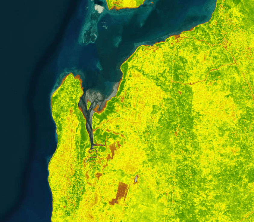
Scalable technology for Africa’s wetlands
The Wetlands Monitoring Workflow for Africa provides geospatial tools and notebooks that government bodies, researchers, and conservationists can tailor to local needs. Using free and open-access satellite data on the entire African continent, it offers repeatable methods to identify wetland extent, monitor changes over time, and conduct classifications specific to country systems. Countries can leverage the workflow to strengthen National Wetland Inventories (NWIs), a key requirement of the Ramsar Convention.
“The beauty of this tool is its flexibility and scalability,” said Mpho Sadiki, a Digital Earth Africa scientist who developed the workflow. “It ensures African nations have the ability to monitor, report on, and manage their wetlands independently using consistent and repeatable methods.”
Recognising the challenges many African countries face—including limited resources, time, and technical skills—this tool provides an accessible starting point for tackling inadequate data on wetland extent and conditions, explains Sadiki. "The workflow is designed to overcome these barriers by using free, accessible data and adaptable code, allowing countries to create detailed wetland maps and monitor changes over time."
Global collaboration for local impact
The new Wetlands Monitoring Workflow tool is already proving valuable, with active implementations in South Africa, Senegal, Kenya, and Uganda through partnerships with local biodiversity and conservation institutions. The tool was developed collaboratively with implementing partners, Regional Centre for Mapping of Resources for Development (RCMRD) in Kenya and Uganda and the Centre de Suivi Écologique (CSE) for Senegal, and informed by valuable inputs and validation data from these organisations, as well as the South African National Biodiversity Institute (SANBI) in South Africa.
At Ramsar COP15, Digital Earth Africa will participate in high-level discussions on National Wetland Inventories and the global GEO Wetlands Initiative, showing how these tools align with international efforts to empower developing nations with solutions for wetland conservation.
"The new Digital Earth Africa tools strengthen the capacity of African Contracting Partners to meet their obligations to the Ramsar Convention on Wetlands using the latest satellite technologies," says Dr Rebelo. "We are excited to expand our efforts to support national inventories, enhance Ramsar site monitoring, and assist countries with capacity-building initiatives to protect wetlands for our common future."
Interested users should reach out to Digital Earth Africa for information on accessing the tools - www.digitalearthafrica.org


 info@businessghana.com

